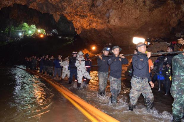
Teamwork, collaboration, database expertise and high-quality digital maps were among the success factors behind the recent cave rescue of 13 boys and their football coach, say tech experts.
"Teamwork and collaboration with others is important -- that's my main takeaway from the cave rescue mission," said Varayuth Yenbamroong, the founder of Mu Space Corp.
Mr Varayuth helped connect the government with Elon Musk when the business magnate offered help with the rescue mission.
"When we went to the cave, we firstly surveyed the needs of the rescuers, evaluating critical technology that was lacking and how we could help," he said. "We later found that accurate weather data was really important to forecasting heavy rain at the cave site the next day."
Once the team realised the urgency of the situation, it quickly contacted some technology partners. Google responded swiftly, Mr Varayuth said.
"They provided us with useful data and weather decision technologies that aided the rescuers with weather forecast models," he said.
Mr Varayuth said Mr Musk's unused mini-submarine could assist future rescue missions in open-water conditions such as the ocean.
"I'm sure these technologies could help save people who cannot swim in the open water," Mr Varayuth said. "Testing should continue."
Somporn Chuai-Aree, PBwatch.net project network leader at the Prince of Songkla University Pattani Campus, who as a volunteer collected data to support the rescue efforts, said the mission provided many disaster management lessons.
Data collection was done by using map modelling simulations and computer visualisations from water routes and landforms.
Data is very important, Mr Somporn said, adding that a high-quality map of Thailand should be made accessible to academics and all government agencies.
"This will enable communities to add details of their local areas to the map," he said.
The map should also include information about the experts so they can be contacted in case of disaster, Mr Somporn said.
"We've gone through many trials -- tsunami and big floods -- and every time we managed without updated data for prediction and prevention, including evacuation plans or best practices for working in disaster conditions," he said.
Vatsun Thirapatarapong, managing director of Cisco Systems Thailand, Vietnam and Indochina, said the cave rescue mission is comparable with a hyper-connected world where international collaboration, particularly, happens fast.
"Collaboration is the new way for project management by gathering experts [who can assist]," he said.
Pun-Arj Chairatana, executive director of the National Innovation Agency, said the cave rescue mission will trigger demand for standard public services related to disasters and rescue operations.
